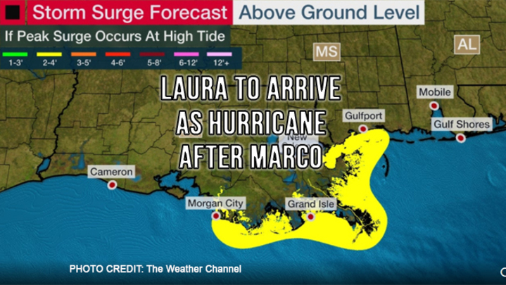
The anticipation of two tropical storms hitting the Gulf coast at the same time is over, but that doesn’t necessarily mean the risk has been reduced. Back to back storms could make search and rescue efforts in between storms dangerous or impossible.
Tropical Storm Marco was upgraded over the weekend to a Category 1 hurricane, but heavy Gulf wind shear quickly returned it to Tropical Storm status. That doesn’t mean Marco will not be a threat when it hits the New Orleans area on Monday afternoon. Wind damage is not expected to be widespread but power outages from downed trees are expected. Rainfall totals are forecast to be 3 to 5 inches, but some areas could see up to 10 inches. The resulting storm surge could reach 2 to 4 feet from Louisiana eastward to coastal Mississippi if accompanied by high tide on Monday and Tuesday mornings. After landfall, Marco is predicted to dissipate quickly.
Tropical Storm Laura is expected to become the first hurricane of the season. A high-pressure system along with the Gulf being free of Marco could allow Laura to build in intensity, reaching Category 2 status by Wednesday. Landfall Thursday morning, somewhere between Texas and Louisiana, is expected to bring a foot of rain and heavy storm surge.
This is a fluid situation as with all weather predictions. We will keep you posted.


