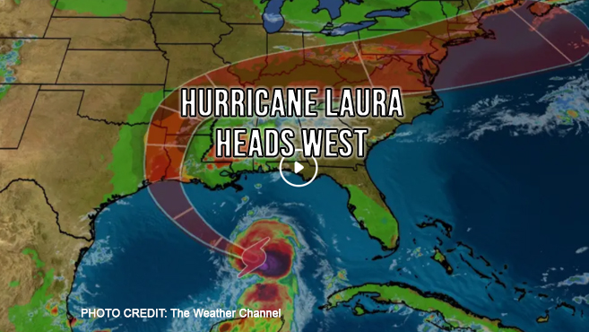
It looks like the Panhandle will get a pass from Mother Nature this time as Hurricane Laura heads west towards Texas and Louisiana.
Compared to the relatively mild impact delivered Monday by Tropical Storm Marco, Laura is expected to pack a much more devastating punch. Already officially a Category 1 Hurricane, Laura has the potential to reach Category 3 (windspeeds over 100 MPH) before landfall early Thursday. Most prediction models have Laura landing between San Luis Pass, Texas, south of Houston, to Intracoastal City, Louisiana.
The National Hurricane Center is expecting Laura to produce 4 to 8 inches of rain from Wednesday night into Saturday, with some areas getting up to 12 inches across parts of the Gulf Coast. This could cause widespread flash and urban flooding coupled with storm surge of 7 to 11 feet along portions of the coast.
This is a fluid situation as with all weather predictions. We will keep you posted.


